28 LORINE RD
Owner Information
JEAN JOACHIM
28 LORINE RD
ATTLEBORO, MA 02703


Property Details
28 LORINE RD is classified as a Single Family Residential (Colonial).
The primary structure on this property was built in 2001. There are 7,734ft2 of built area within this property. There is 3,046ft2 of residential/living space within this property. This property is listed as having 12 rooms.
28 LORINE RD is valued at $613,300. The land is valued at $161,100 and the structures are valued at $444,000. There is an additional valuation of $8,200 on this property.
This property is in Zone SRD. Confirm with local Zoning Board authorities to ensure there are no overlays or other easements on this property.
The most recent deed for 28 LORINE RD is recorded at the local registrar in Book 23704, Page 0034. 28 LORINE RD was last sold on Tuesday, April 25, 2017 for $515,000.
Assessment data from fiscal year 2021.
Flood Data
According to the FEMA National Flood Hazard Layer, this property does not appear to be in a flood zone. It may also be in an area not yet reviewed. Nonetheless, confirm this information prior to taking any action.
To view the flood hazards around this property, create a FEMA "Firmette" Map of the area around 28 LORINE RD.
Broadband Internet Providers
| Provider | Type | Bandwidth (mbps) | |
|---|---|---|---|
| Viasat Inc | Satellite | 100 | 3 |
| Comcast | Cable | 1000 | 35 |
| VSAT Systems, LLC. | Satellite | 2 | 1 |
| HughesNet | Satellite | 25 | 3 |
| GCI Communication Corp. | Satellite | 0 | 0 |
| Verizon New England Inc. | DSL | 5 | 0 |
Broadband service provider data from December 2020.
Adjacent Properties
- 31 LORINE RD
Single Family Residential owned by DECOSTE RICHARD P II & SUZANNE L - 24 K MARIE DR
Single Family Residential owned by GORMAN THOMAS J & MARGARET I - 30 K MARIE DR
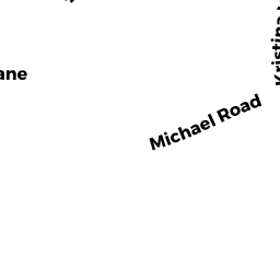
Single Family Residential owned by COREY CLAUDIA A & KEVIN M - 43 MICHAEL RD
Single Family Residential owned by BAILEY NEIL T & REBECCA L - 20 LORINE RD
Single Family Residential owned by STANDRING ANDREW J & BONNIE